I am just figuring out how this blogging thing works, so give me a little slack as I get things up and going. So, this is kind of a test:
Let’s start with some basics. When the idea of sailing away was a mere inkling of my (or rather, Allen’s) imagination, my first reaction was “not in this boat”. At the time we had a nice 28.5 Hunter, with a comfy v-berth for sleeping, but no storage, no refrigeration and a head (aka toilet) that was for emergencies only, there was no way I could fathom sailing away for more than a day or two. Then came Meshuggana.
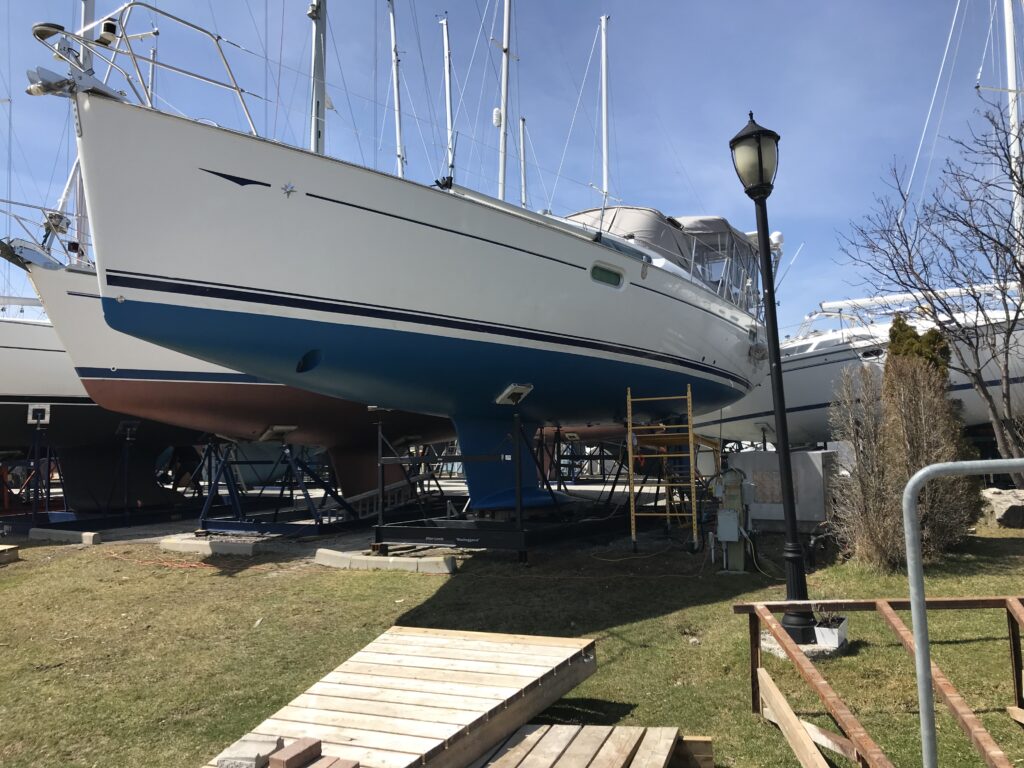
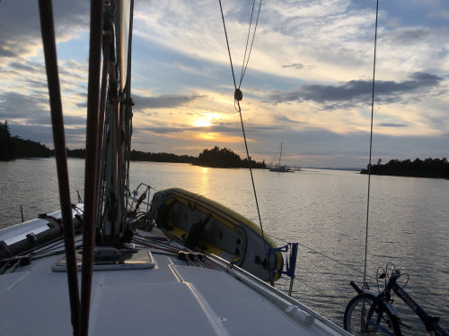
Meshuggana is a 42′ Jeanneau Sun Odyssey Deck Salon. We picked her up near Chicago, trucked her to Toronto and Allen has spent the last 5 years upgrading “his mistress”. So, we have refrigeration, heat and AC, solar, radar, sonar, wifi, real heads (bathrooms) and a king sized bed – we are not roughing it. But we are in for an adventure – come along with us as we explore the Great Lakes!
Here we go – Our Great Lakes Adventure! One week is in the books, and it’s been
educational, at times frustrating, but overall one of the best weeks of my
life!
The question I’ve been asked over and over is “how do you prepare
for this”? It’s a question I asked
myself at least 100 times a day since March, when I put the For Sale sign on my
front lawn. How do I deal with the
contents of a full house? Decide what to store? What to sell or give away? And
most importantly, what comes with me on a 400 square foot boat that I will call
home for almost 5 months? There is no
easy answer that question, but after several anxiety attacks, some tears and
with the help of one very patient husband, and a son willing to move boxes and
furniture (and promise to drive up and visit), it all got done.
My rule of thumb was if it was easy and inexpensive to
replace, bring just a little bit (ex: tomato sauce, eggs, bug spray, batteries). If it may be difficult or expensive to find,
bring it (ex: Starbucks coffee beans and special diet cat food). Observations after one week– I have way too
many sweaters, every small town has a pretty decent grocery store, and absolutely
no chance of finding a Starbucks on this route.
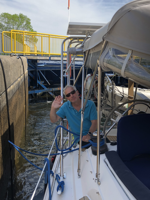
We left the docks of our Ashbridges Bay Yacht Club (ABYC)
at10:10 am on Friday, May 24, about 5 days later than planned. We were delayed by easterly winds and waves
from the east, which would have made the trip very uncomfortable at best, but
could have been disaster. However, this delay was fortuitous for two reasons –
the Trent Severn Waterway delayed opening by 1 week due to high water and
currents and it gave us a few extra days to prepare and spend extra time with
loved ones.
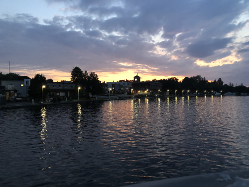
Tonight, as I sit in the cockpit our home, currently in Bobcaygeon,
ON, tied up to the wall by Lock 32, enjoying late afternoon sunshine and hoping
the 25 knot winds die down, I reflect on what has been at once one of the most
terrifying, yet most exciting decision of my life:
It may be cliché, but it is true – there will
never be a perfect time to follow your dream, so you just gotta make the decision,
do some research and go for it!
I have HUGE respect for the power of water –
wowsa!
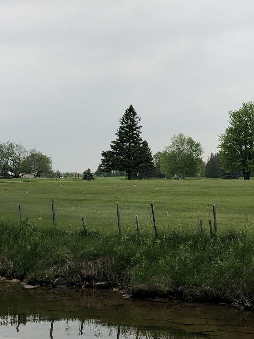
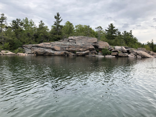
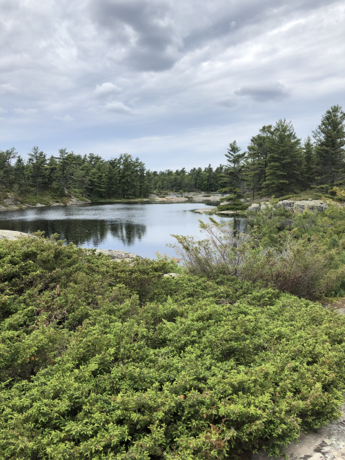
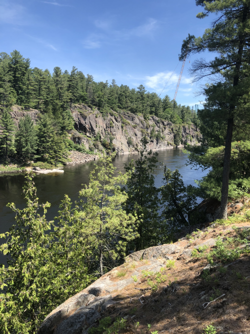
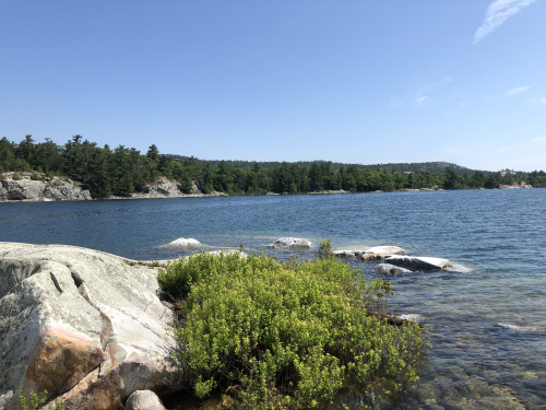
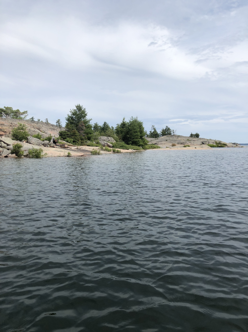
Ontario has some of the most breathtakingly beautiful
landscape, from the lush greenness of the lower Trent area to now the stunning
granite of Kawartha. I can’t wait to see
what’s next.
Boaters are really, really nice people – always willing
to lend a hand and no judgment when the wind catches your bow and you blow the
docking.
Wi-fi is our most precious commodity.
And finally, but certainly not least – take your
best friend along on your adventure – Allen, my best friend, husband and my
captain (nothing sexist here, he’s just got the experience), and the ever
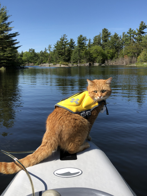
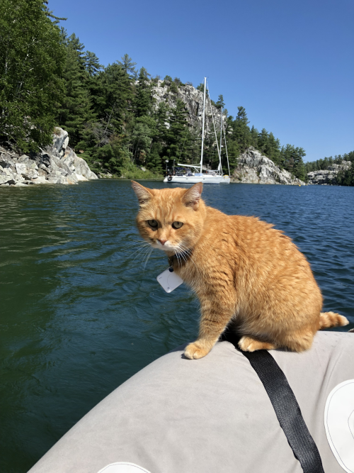
precocious Cat Stevens – sometimes referred to as Houdini or Little Bastard,
but always entertaining.
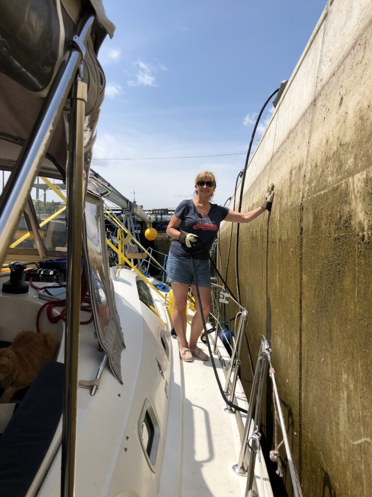
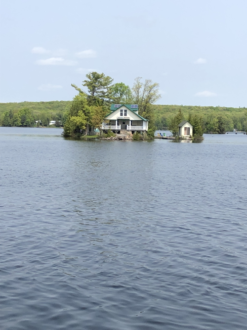
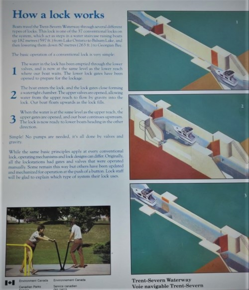
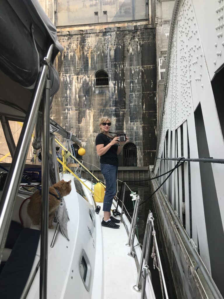
Inside a typical lock…a little slimy, a little stinky, but pretty cool…at least for the first 20.The sun can’t shine every day.Cat Stevens…Cruise Director…Houdini….Little Bastard…soaking up the sun.A lovely little cottage in the Kawarthas.Beautiful landscape.
When Allen and I just began noodling around the idea of sailing the Great Lakes, we thought about putting Meshuggana on a truck and taking her to Georgian Bay/Lake Huron by road and beginning our adventure there. We then learned that Allen’s masterpiece, the arch he designed, built and installed on Meshuggana, made us too tall for highway travel – we would not clear some of the bridges.
The alternative was to go by water, west
through the Welland Canal, locking-upstream along with all the other freighters
and commercial traffic going to Lake Erie and then navigating the Detroit River,
connecting Lake Erie to Lake St Clair, and fighting its 7 mph currents upstream.
While doable, this route is not for the feint-hearted sailor. Then the TSW idea was born.
We always assumed the TSW would be too shallow, bridges too low, and really, we didn’t know a soul who had ever travelled it in anything bigger than a kayak. But the idea was there so we had to do some research. We learned that the TSW is in fact navigable by larger boats and they guarantee at least a 6 foot depth throughout the system (we now know this is not true). Meshuggana draws 5’4”, so having just inches below the keel was a little disconcerting, but the solution was high water – Spring.
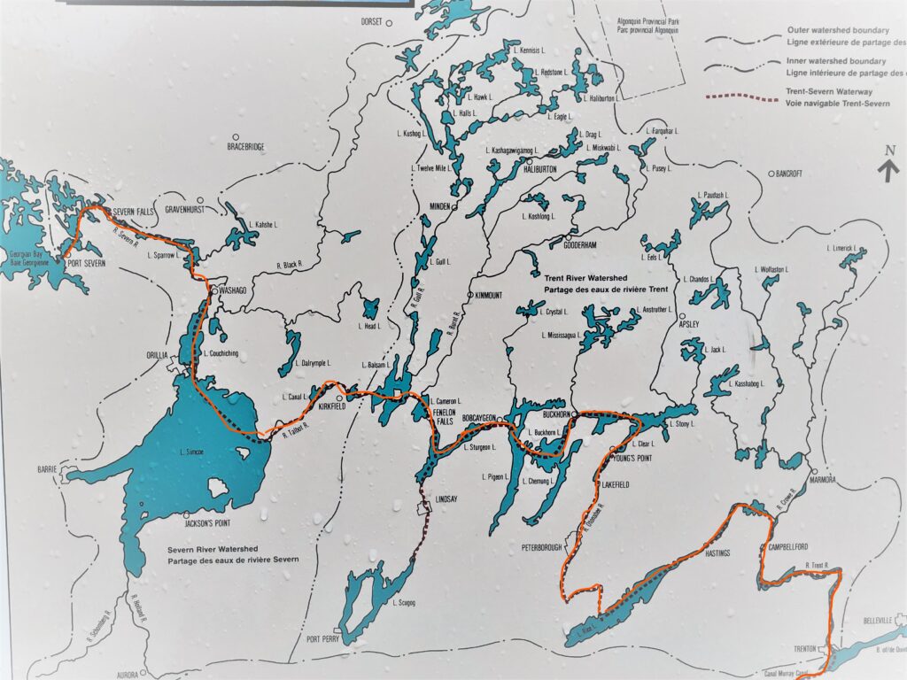
So what is the TSW? I admit that a year ago
I didn’t know much about it. I had heard
of the Trent River, the Lakes Rice, Buckhorn, Sturgeon, Simcoe, Couchiching,
the towns of Bobcaygeon, Fenelon Falls, Orillia, but I had no idea they were
connected….I had no idea that Lake Huron was connected by water to Lake Ontario.
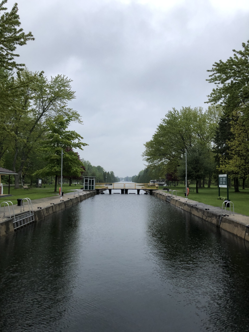
The TSW is a now a national historic site
managed by Parks Canada. It spans 386
kms, has 44 locks, including the highest and second highest lift lock in the
world, Peterborough and Kirkfield. The
locks are numbered 1-45, but lock #29 was decommissioned when it was combined
with lock #28, so there are only 44 locks now.
The system was originally conceptualized in
the 1830’s as a military route, but this idea was soon abandoned because of the
many rapids along the route. However,
the economic advantages of moving product along the canal made sense, and the first
lock was built in Bobcaygeon for the lumber industry. This led to more locks, but eventually, they
had a neat little land-locked lock system that became obsolete with the advent
of better roads and railways.
In the 1880’s, the Conservative party leveraged commercial interests to complete the system and the full canal system was finished in 1920, opening up a commercial waterway from Lake Ontario to the other Great Lakes. Then in 1932, this little thing called the Welland Canal opened, making the TSW pretty much obsolete for commercial traffic. Today it remains a tourist attraction and runs through the heart of Ontario Cottage Country.
Our route hi-lighted here. As I write this post, we are in Orillia.
As we near the end of our TSW journey, here
are some thoughts and observations:
The TSW is a gem! Come out an experience it, whether it’s cruising all 383 kms or just spending an afternoon or weekend in a fishing boat or kayak. If you are travelling by sailboat, stay vigilant to remain in the channel and watch your depth.
Parks Canada does a fantastic job managing the waterway, which is a far more complex job than I ever imagined. In additional to running the locks, the lock masters are responsible for water management of the entire system with the dams as well as maintaining the facilities. These are not summer students, these are full-time careers and they are knowledgeable, friendly and helpful. The facilities, from the meticulously tended park-like gardens to the clean washrooms are spotless.
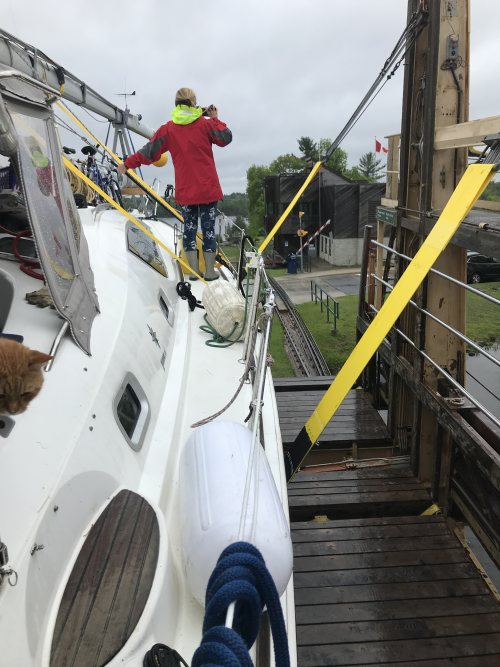
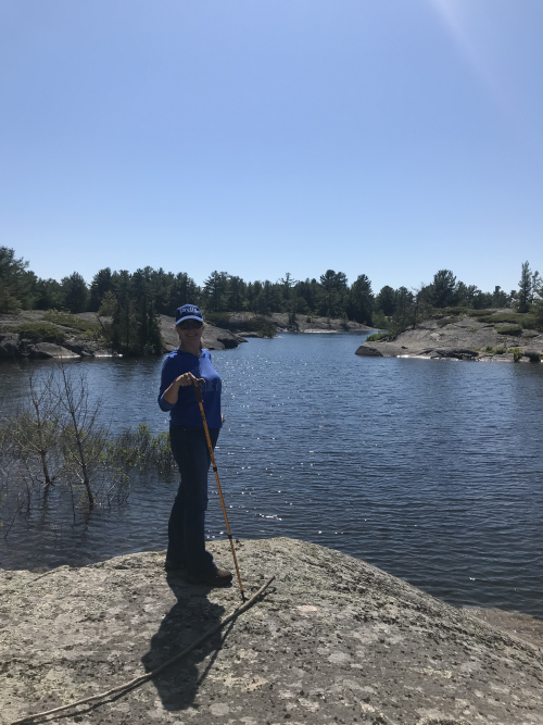
The locks are super cool. Most of them are over 100 years old and have not changed much in that time. Some are slimy, smelly and crusted with zebra mussels with wooden doors that leak like a sieve and some have been updated and have smooth concrete walls and massive steel doors that clang shut like something out of Lord of the Rings, but for the most part the technology has not changed. You enter your first few locks with your pulse racing, but by the time you get to the 10th, 20th,, it’s pretty routine.
Going up in the Peterborough Lift Lock, the world’s highest lift lock. Cat Stevens is an excellent supervisor, making sure we manage the lines and then has a chat with every lock master when we reach the top.
Leaving the Kirkfield Lift Lock (second highest), our first downstream lock. We “bounced” in the collected silt coming out of this lock.
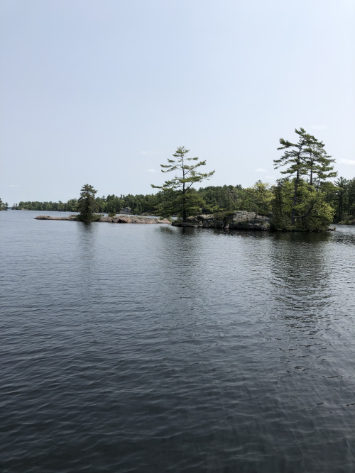
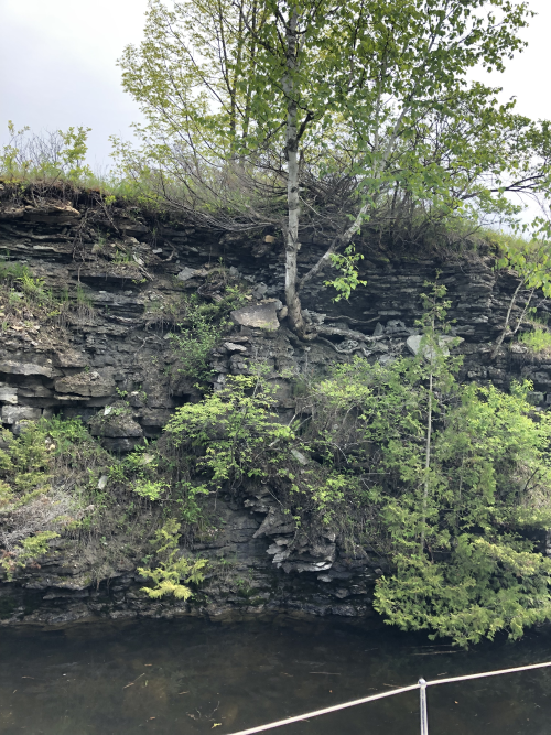
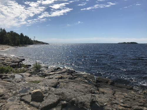
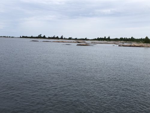
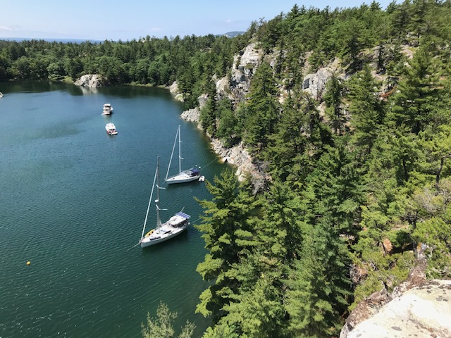
The rugged beauty of the Canadian Shield on full display. That rock extends all the way under the water, so extreme care needed to stay in the middle of the canal.
Rosedale lock, the highest lock of the TSW system.
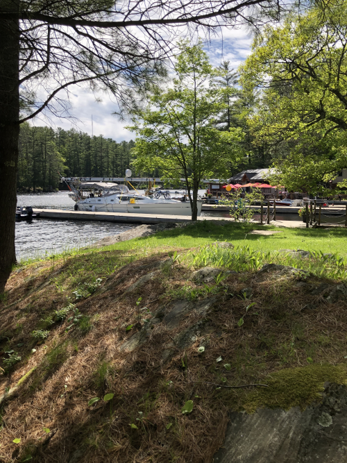
Tourism is the biggest industry on the canal and these cruise boats as well as rental house boats abound in the more populated areas.
The stretch between Canal Lake and Lake Simcoe goes through farmland – we literally cruised through famers’ fields.
Allen and I are having a debate – is Georgian Bay part of
Lake Huron? He says no, it’s just
Georgian Bay. I say yes, it’s a bay in
Lake Huron, the same way Toronto is a city in Canada. I don’t want to waste precious data
researching this, so if anyone out there has the correct answer, please share.
Monday, June at 13:20 we cleared lock #45 in Port Severn, after 17 days and 43 locks (lock #29 was decommissioned and #33 in Lindsay is off the route), we officially left the TSW and motored into Georgian Bay. The last few days in the TSW were quite eventful, in some wonderful events, and some not so wonderful
From Rosedale lock we motored into Balsam Lake, the summit of the system. At that point, we had climbed 182 meters above our starting point from Trenton/Lake Ontario. In those first 33 locks we “locked-up”, and the in the next 10 we would “lock-down” as we descend toward Georgian Bay.
Kirkfield Lock, #36, at 65 feet, is the second highest lift lock in the world, second only to Peterborough. When locking down and driving into the lock, it feels like you are going to drive off the edge of the earth, a little unnerving; however, the staff are there to grab your lines and tuck you in. A beautiful smooth ride to the bottom, and then we bumped bottom as we exited the lock. A build-up of silt so no harm, but an omen of things to come. When planning this journey this winter, our biggest concern was water depth of the Narrows in Lake Couchiching. Charts show that for about 200 critical feet, depth is only 4 feet (we need 5’5”). We were assured Spring levels would accommodate, so we took the leap of faith. HOWEVER, we did not know about Canal Lake!
Canal Lake was 4 nautical miles (over an hour of travel) of stomach-churning hell! We knew it wasn’t going to be good when we saw the weeds floating on top of the water, downed trees, and branches poking out. We hit bottom almost immediately. Then again. And again. In fact, we never floated in Canal Lake. Throttle down, we dredged the entire lake. We got through, but felt a bit nauseous – sailboats are not meant to dredge lakes.
Then came Couchiching and those first 200 feet. The high water currently plaguing the Great Lakes was the advantage we needed, and with more than 9 feet beneath our keel as we easily glided into Orillia. Orillia has beautiful city docks and facilities (similar to Trenton), so we took in a show at Rama (David Foster), a movie (Rocketman), topped-up water tanks, restocked the fridge, dined out and even had attended the Orillia Boat & Cottage show. With warm and sunny weather, Orillia was a much needed break.
After 3 days off, “back to work”. The trek from Orillia to Port Severn is slow going due to heavy cottage country boat traffic and several swing bridges plus the locks. We dined and overnighted at the lovely Waubic Inn (boat access only). Tasty, simple food and incredibly friendly, gracious hosts – highly recommend you’re ever in the area.
Meshuggana docked by The Waubic Inn.
Big Chute Marine Railway! Wow! We were a bit nervous going in – putting the boat in a giant cradle and having it driven across a ROAD, down a big hill and plopped into a lake! Easy-peasy! Smooth, steady ride and a free keel inspection to boot! The lock masters were happy to check the bottom and they confirmed all we lost was some paint, no damage.
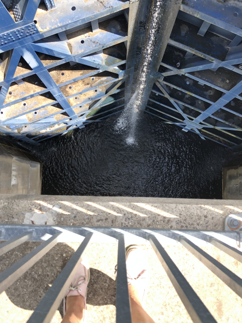
That’s me on deck, crossing the road on Big Chute.Looking down into Swift Rapids Lock – 47 feet down!Captain Allen, in Swift Rapids Lock.
So Chapter 1 is done. Would I do it again? In a heartbeat. But maybe not in a 42’ sailboat.
Coming up next: a technical blog from Allen….stay tuned!
First let me say that I am no authority on the subject and
my recommendations are based only on my own observations. That being said let me begin.
Parks Canada states that it is possible to travel the TSW
with a 6’ draft. I strongly disagree
with that assessment. We entered Lock #1
at Trenton the day after it opened in the spring, during one of the highest
water level years on record. We draw 5’4” and have a bulb keel on our 42’
sailboat, and displace a little over 21,000 pounds dry. Needless to say, the mast was as well secured
horizontally on the deck of the boat and yielded a minimum bridge height
clearance of 15’.
The journey upbound to the highest lake at Rosedale had us
travel through 35 locks. One of our
biggest bounces was 50 m in front of the centre of the marked channel while
entering the famous and most traveled Peterborough lock. I lost count of how many times we skipped
along as we approached the Kirkfield lock, despite water breaching the top of
Roseldale’s lock doors.
However, almost as nerve racking as feeling the ground
beneath our keel, were the weeds, especially so early in the season. I have
two major recommendations:
If you have a large wing on your keel or draw
more than 64”, consider journeying to Georgian Bay through the Welland Canal
and Lake Erie! The weeds in the TSW will
wrap around your keel and bring you to a grinding halt. You will have to stop
and clear them every 100m if your keel edges exposed for the weeds to wrap
around and drag you to a crawl.
If; however, you do not mind plugging your way
through, my biggest recommendation to save your sanity is to have either a
traditional sonar transducer on board or at least a portable fish finder. If you rely on the single depth reading you
see on a typical sailboat which just gives you a depth number, you cannot see
the consistency of the bottom. A single
frequency depth sounder signal will bounce off the top of the weeds giving you
readings shallower than your draw. You will never know the true depth, and as a
result will be biting your nails not knowing what your real depth is. Traditional sonar or a fish finder will graphically
shows what the bottom looks like and the weed stalks growing up from the bottom
can be seen. It provided relief when we saw negative depth readings and helped
us to avoid some bumps through some very weedy sections (about 40% of the time).
The biggest problems were not in the man-made canals, but rather the openings
and exits to these canals. Oh, and by the way, get used to seeing only 6 inches
under your keel for most of the way.
Here is a statement of the obvious. NEVER, NEVER leave the
the marked channel, even by a few feet. That means no authohelm, even in the
long straight sections. Don’t circle in
front of a lock waiting for the doors to open, or run the chance of slightly
crossing the imaginary line between the calm water sheltered by the breakwall of
the lock entrance and the turbulent outflow of the adjacent dam. Although you
would still be technically in the channel, your slow speed crossing into that
raging current will throw you out of the channel and aground faster than you
can say “Jack Robinson”. Thank God for our bow thrusters that pointed us in the
right direction so we could drive right off.
Did I mention the raging current? At high water, the amount
of water coming out of those dams looks like a great place for extreme kayakers
to have the time of their lives. My experience with this was coming into Lock
#4, heading to the breakwall separating the lock from the dam, I had to keep
the boat at a 45 degree leeway (angle of the bow relative to the direction you
wanted to go). So make sure your boat
has enough horsepower to fight the current and if you only have a 9.9 outboard
on the back that only sticks in the water 12”, then consider not doing the TSW.
No matter how many fenders you have, it is not enough, so
prepare to scratch your hull. Not on the lock walls, but the concrete piers you
pull up to and tie off to while waiting for the locks to drain and open. I have never experienced switching currents
like this. The currents can flip 180 degrees several times during a 5 minute
wait, and the speed is faster than you can react to and the power is stronger
than anyone can fend off. Most of time
we had only 3 mooring lines out while waiting, but when the current switches, the
third line was likely in the wrong direction and the fenders popped out. Lots of gel work to do this winter.
Locking down the TSW truly is simple, but exiting the locks
is still nail biting as you wait for the bump of silt that builds up at the
exit of many of the locks. Even with record breaking water levels this season, Canal
Lake was our nemesis. I swear the keel dredged through mud and weeds the entire
4 NM. A sailboat that draws 6 feet as
per Parks Canada would never make it through.
Once we made it to Lake Simcoe, things started getting
easier. Even at the narrows in Lake Couchiching which shows the chartered depth
at 3’ over a stretch of 50m. It actually turned out to be more like 8’.
Was it worth it? Yes, it was as the scenery and cottages
made it all worth while. Would I do it again? Not in a sailboat that draws over
5’.
Today is Friday, June 21 and we are exactly 4 weeks into our
journey – could we really be ¼ of the way through? Time goes by in a blink, but then again,
sometimes I hardly remember living as a “land-lubber”. Some observations from my first month living
in a tiny space, with no set address:
I packed way too many clothes! But as usual, forgot a few key items I have needed to pick up along the way (a belt, socks).
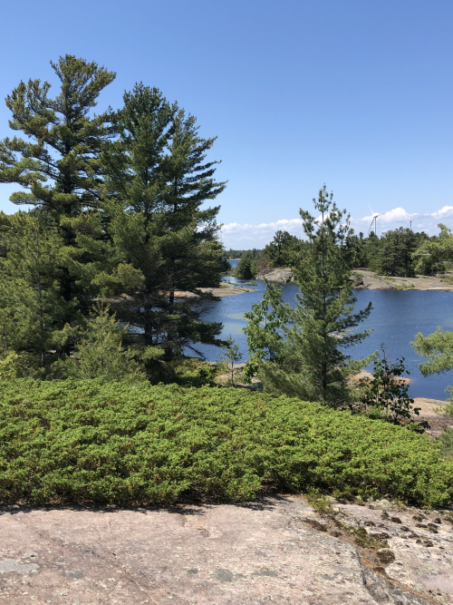
The Ontario landscape is breathtaking! Just when I think I’ve seen the most beautiful rock formation, bay or sunset, another one surprises me. Get out there and see it, by sailboat, kayak or car, just get out there.
A healthy lifestyle is easier on the boat. Every day we’re out walking, hiking or just managing the boat. Junk food– if it’s not on the boat, there is no way easy way to get it. I’ve lost 6 pounds since starting the journey and Allen has a decent six pack. We are the fittest we’ve been in decades!
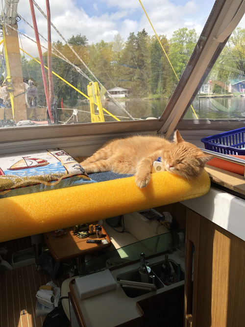
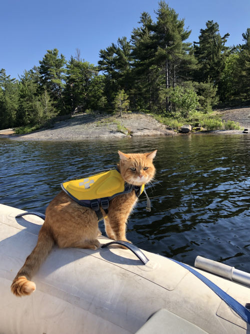
My cat is a rock star. Check out his Instagram: catstevensthetravelingcat
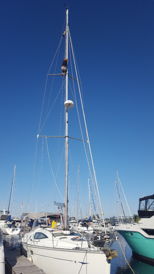
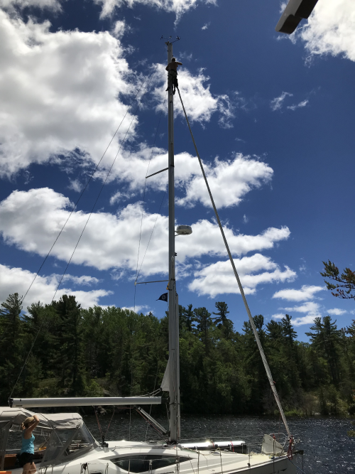
On Monday June 10 we arrived in Midland and pulled into the
marina for a couple days to prepare for the next leg. We carried our mast mounted horizontally
across our deck to get through the TSW’s bridges and locks, but in Georgian Bay
we can become a sailboat again. Our mast weighs more than 1000 pounds and all
our electronics run through it and connect to the boat (radar, lighting, wind
instruments, antennas), so this is a heavy, but delicate operation requiring a
crane, a crew and lots of patience.
Fortunately for us, my sister and brother-in-law drove up to lend a
hand. Midland is also a bigger city with
many resources, so we could stock up on groceries and other necessary
supplies. It was also incredibly good to
have some family time.
Holding on from 40 feet.
It was worth the trip up the mast.
The forecast told us 25 knot winds were coming, so we needed
a safe, protected anchorage. Frying Pan
Bay, about 3 hours from Midland, is a spacious, deep water bay, with great wind
protection from all sides, surrounded by public park land. We were aware that this bay can get very busy
on weekends, but arriving mid-week, in a wet, cold Spring, we thought we’d have
the place to ourselves. Wrong! There were at least 9 other power boats
already there, in what looked like a guys’ trip of fishing and beer. They were harmless, but hogging the public
dock so going ashore with the dingy was a little awkward. We rode out the wind storm and two days later
headed to Bernadette Island for our next anchorage.
Now that’s a convenience store!
Bernadette is accessed through narrow channels of deep water
and huge rocks and shoals if you venture anywhere outside the channel; however,
that pretty much describes all of Georgian Bay. Another storm was coming, so a secure
anchorage was our primary concern. We
tucked into a cove, our anchor holding well and tied off the stern to shore to
prevent wild swings in the wind storm.
After 2 stormy days and nights cooped up in the boat, we were treated to
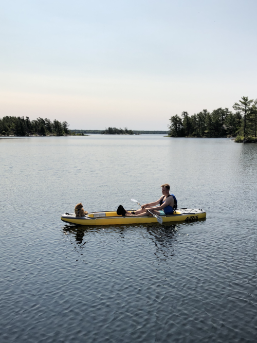
a lovely sunset and kayak trip, the first ever with Cat Stevens. Well, to say
he took to kayaking like a natural is an understatement, even after he took a
spill into the water. Now he jumps on with no hesitation and goes for a
paddle.
Sailor in his previous life?
Next Stop – Wreck Island, part of the Massassauga Provincial
Park system. As Bernadette is surrounded
by private property and No Trespassing signs, this anchorage gave us an
opportunity to get off the boat and stretch our legs on the hiking trail. With Cat Stevens on his leash, we spent
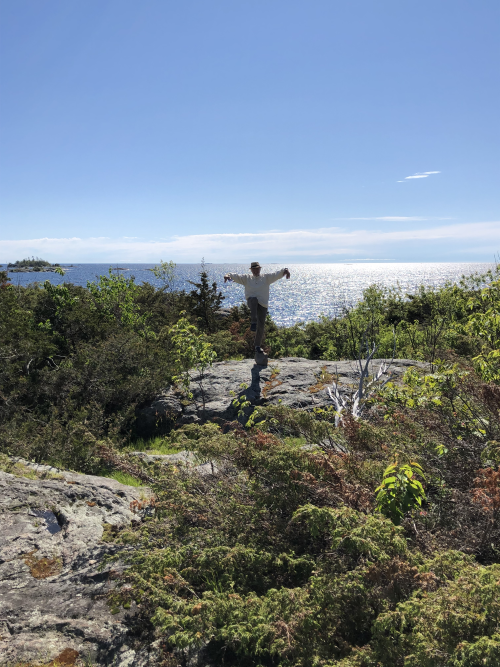
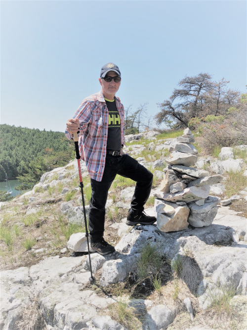
several hours hiking through forest and climbing impressive granite slopes
along the shoreline. We also decided
next provisioning stop, buy hiking boots.
Shoreline of Wreck Island
Karate Kid on Wreck
After 5 nights of “swinging on the hook” (anchoring), we
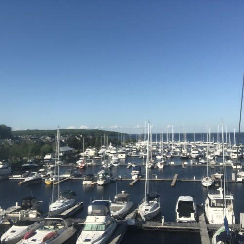
pulled into Parry Sound for fuel, holding tank pump out, provisioning and good
wi-fi. The “Home of Bobby Orr” is off Highway
69 and has always been a good spot to fill the tank and move on north, so this
was our first visit to this town. A
lovely downtown core with mom & pop shops, independent restaurants, a brewery,
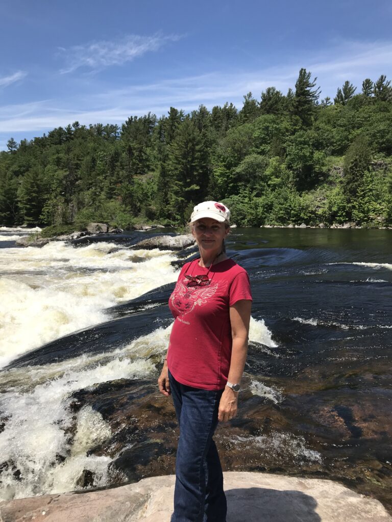
free summer concerts and a river with rapids running through it, was just what
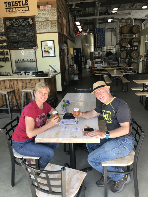
we needed to restock the boat and recharge our own batteries.
Recharging at Tressle Brewing Company in Parry Sound.
We’ve moved back to nature the last 2 nights, anchoring off
Franklin Island near Snug Harbour. A provincial park, Franklin Island is known
as a kayaker’s paradise. No
kidding! Allen and I set out in the
dinghy planning to circumnavigate the island.
Our planned 1-hour tour turned into a 3 hour tour! This island is huge, with so many coves and
crannies worth exploring. One cove
turned into an interior lake, and then another and another. This is home to osprey, loons, turtles, all
kinds of birds and we read that bears live here too (though we didn’t meet
any). It would take a week to see it
all. Being here mid-week, we didn’t see
another soul on the island and sometimes it felt like we were the first humans
to explore it. Then we turn a corner and
see a camp fire pit or inuksuk indicating this place must be crawling with
kayakers and campers on weekends. So
glad we could experience it as we did.
One of many beautiful rocks on Franklin Island.
One of many lakes inside Franklin Island.
Hiking on Franklin.
In about an hour we will be pulling up the anchor and
heading to Pointe Au Baril for a special treat – my boy is coming up for a
visit, so signing off until next time.
Gunkholing: a type of
cruising in shallow water, meandering from place to place, spending nights in
coves. Yes, we are gunkholers. This is a lifestyle for those who aren’t
afraid of not knowing where they are going to sleep tonight, can take some
educated risks, perhaps a sleepless night or two, even an occasional light tap
on the keel (for you non-sailors – this means hitting bottom), no wifi or data,
all in search of the perfect anchorage: calm water, protection from winds, but
most of all, solitude with a view.
To gunkhole properly, you have to leave the marked channel
(the safe route that Transport Canada marks with navigation buoys) and move
into uncharted waters that may or may not have enough depth for your boat and
may or may not have submerged rocks,
islands or tree stumps. This is not for
the feint-hearted, nor for anyone without good electronics or polarized
sunglasses.
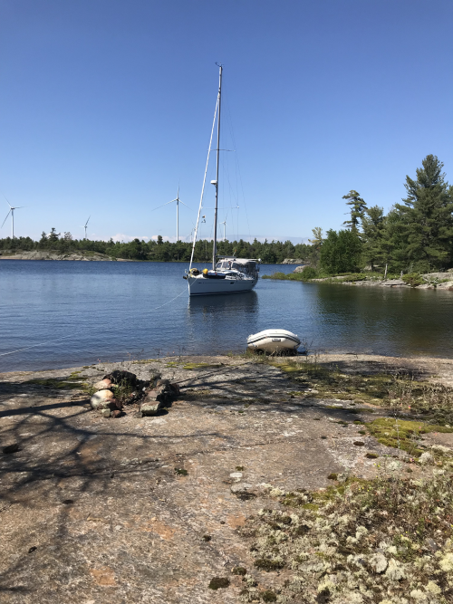
Gunkholing with Meshuggana
After a couple days in the big city of Parry Sound (“Big City” is defined as more than one restaurant, a grocery store, Walmart and a Canadian Tire), in a marina with all of life’s conveniences (defined as hot showers, shore power, wifi and laundry facilities), we were ready for some gunkholing and set out in search of that perfect anchorage. What made it really special for me was my son, Davis, was coming to spend a day with us; however, that added a challenge of finding a place where we could anchor and Davis could leave his car overnight and we’d be able to pick-up and drop-off.
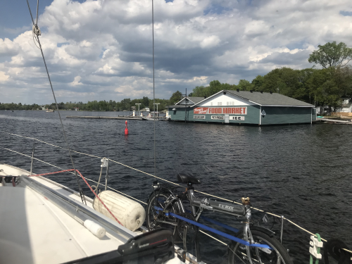
Point au Baril is a tiny hamlet between Parry Sound and Sudbury. Once a busy metropolis (see definition of Big City above), it now consists of several small power boat marinas, a single hardware/grocery store and a chip truck. However, for a mere $15, one can park a car at a marina and we can get in with our dinghy for easy pick-up and drop-off.
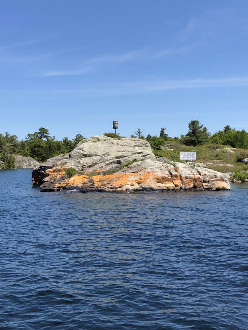
Entrance to Pointe au Baril from Georgian Bay. In the old days, the apparance of the barrel indicated safe waters. Later it was replaced by a lighthouse.
Point au Baril Lighthouse
Tucked far into Hopewell Bay off Shawanaga Island, with 8 feet of water beneath our keel, well secured between a rock island and shore, we were a mere 1 hour dinghy-boat ride away from Pointe au Baril. I had everything I needed: good protection from wind, calm water, postcard perfect landscape and the company of my 3 boys – Davis, Allen and Cat Stevens. Add some good food, kayaking, music, a little wine and my heart was full. Time went by in a flash, and before I knew it we were journeying back to Point au Baril to send my boy off to the REALLY big city (Toronto).
Davis kayaking with Cat Stevens.
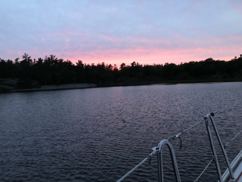
Sunset from Hopewell Bay.
Next stop Nares Inlet. I wish I knew exactly where it is, but that’s the thing with gunkholing – I really don’t know where we are most of the time. We found a quiet cove off of a larger bay, with cottages and an occasional fishing boat. This was a near perfect spot, secure and with beautiful scenery, but we were surrounded by private property and so leaving the boat to hike and explore is not really an option. Most cottagers are friendly; however, it’s not really OK to hike on their property without permission.
Sandy Bay, about an hour past the Byng Inlet, was our next destination. To get there, we navigated a minefield of rocks, some visible, but many submerged due to extremely high water levels in Georgian Bay. Communicating with walkie-talkies and hand signals, Allen drives the boat and watches sonar, while I stand on the bow looking for underlying hazards. Just one good hit on a rock could end our trip and do tens of thousands in damage to Meshuggana.
Minefield of rocks, some visible, some submerged.
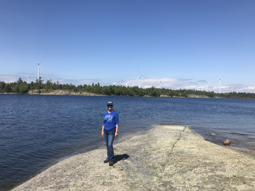
We were told Sandy Bay is usually buzzing with boat and cottager traffic, but we found it completely secluded. In fact, we did not see a single human for 3 straight days – not a fishing boat, not a kayak, not a cottage, not a hiker, and only sporadic data and cell service. The only reminder that we were not the only humans on earth were the long-ago used fire pits on massive pink granite slopes on shore and the 100 wind turbines right across the bay.
An interior lake near Sandy Bay with a wind turbine in the background.
The Henvey Inlet First Nation Reserve is comprised of 3 native reserves, Henvey, Sawanaga and Magnetawan reserves. The wind farm is the first wind power project on First Nations land, the largest in Ontario and has the highest hub-height (distance from ground platform to blade rotor) in North America. It’s strange, being in the middle of staggering natural beauty peppered with wind turbines. I’m not sure if I found them ugly or just interesting; however, they provide economic opportunities and jobs to First Nations people now and for generations to come.
An old fire pit and some turbines to remind us we are not alone.
Look at all those wind turbines!
We stayed in Sandy Bay for 3 nights, waiting out 25 knot winds and 4 foot waves in Georgian Bay. While not really dangerous for a 42′ sailboat, travelling would have been incredibly uncomfortable, not only for us, but especially Cat Stevens. And as gunkholers in a calm, safe anchorage and a vast amount of (public) land to hike and explore, there was no reason to leave.
Even Cat Stevens enjoys the solitude of Sandy Bay
The stakes of gunkholing can be high, but so are the rewards of finding the perfect anchorage. Eventually we did leave our serene anchorage to journey back to the Byng Inlet and the village of Britt, to spend some time with family and finally some civilization…solitude is nice, but I can only take so much!
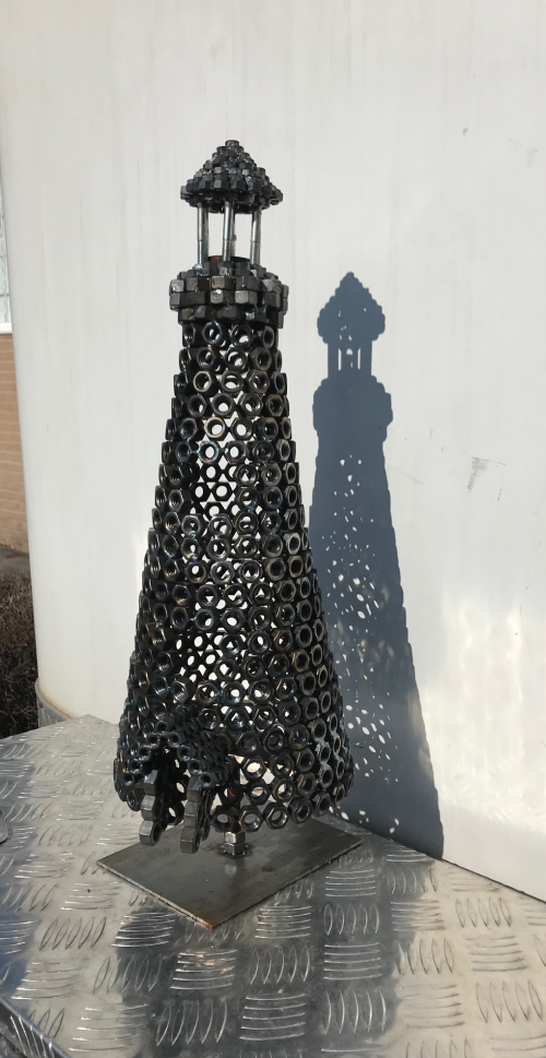
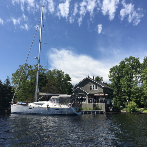
Our journey took us to a very special place: Britt, Ontario on the Magnetawan River, off Georgian Bay. Growing up Allen spent many happy days at the Andrews’ family cottage in Britt, now the lovely summer home of Naireen (Andrews) and Ian Lowe. Allen’s parents, Saul and Tobie, continued to travel to Britt into their final years, to enjoy the beauty and tranquility and spend time with Naireen and Ian. To honour his parents’ memory, Allen created a memorial in the shape of a small lighthouse, which now stands on the break wall in front of the home. As we navigated the Magnetawan River, Allen was not sure if he’d recognize the Lowe’s home as it’s been many years since his last visit, long before the new home was built. But there is was, on the shore, the little lighthouse, directing us into safe harbor.
Lighthouse memorial for Saul and Tobie Lewis.
Meshuggana docked in Britt.
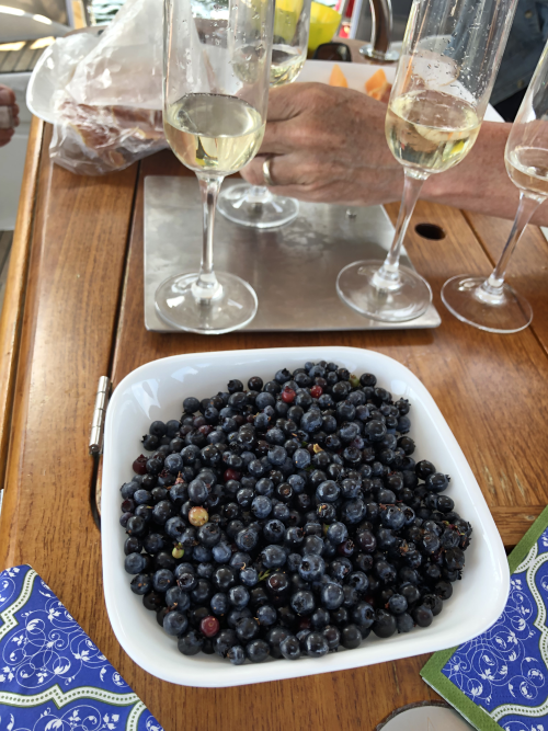
Docked in front of the Lowes’ home, we spent several sunny
days with family enjoying the luxuries of land-living (hot showers, clean
laundry and wifi) and took in the Britt Canada Day Boat Parade, with “front row”
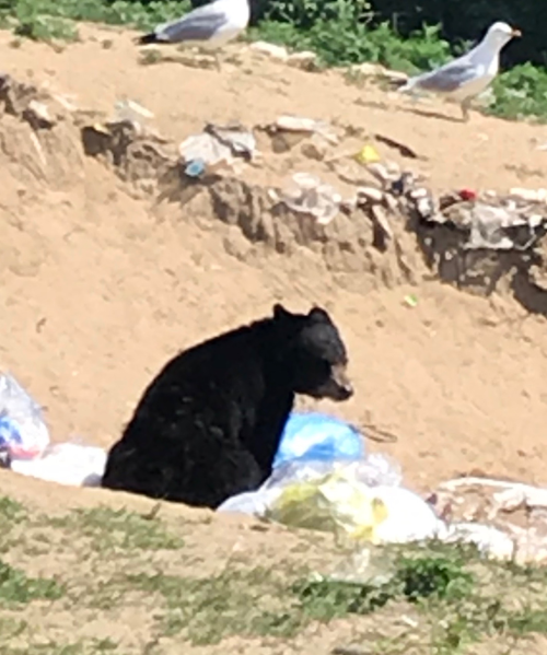
seats in our cockpit, day trips to the French River Park, the Trading Post and
of course, the local dump so see some wildlife.
French River
Happy Canada Day from Recollett Falls, French River.
Baby Black Bear looking for lunch at the town dump.
Cool evenings with family dinners, a bonfire and learning
new card games made this the perfect break from gunkholing.
Allen fixing instruments at the top of the mast.
Our break culminated with a trip to Toronto to take in the
Latvian Song & Dance festival. Borrowing
a car, we made the 4 hour drive to the REALLY big city. After 6 weeks of living on a boat, it felt a
little odd to put on nice clothes, heels and make-up! First stop hairdresser, then a mani-pedi,
then I was ready to re-join civilization.
Latvian Song & Dance festivals have always been very
special for me, as a former participant (I folk-danced in my previous life) as
well as an opportunity to reconnect with family and lifelong friends from near
and far. I’ve been asked what is the
hardest part of this Great Lakes journey.
It’s not living in a small space, not the rain, the insects, or the cold
(soon to be hot) weather, or even the submerged rocks and nasty waves. It’s missing our family…our kids, grandkid,
siblings, nieces/nephews, cousins. We were blessed to spend time with all, even
if brief – my heart is full.
GVV (Latvian summer high school) Roommates’ Reunion.
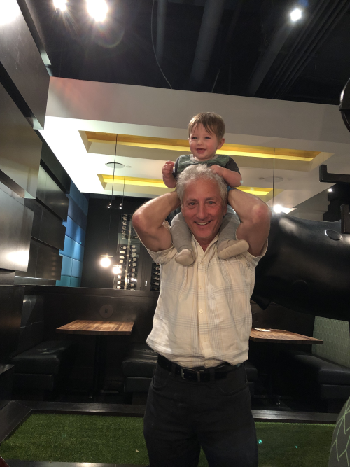
Giving grandson Tommy a ride.
Now we are recharged both spiritually and physically – fridge and freezer filled, holding tanks
empty, fuel-up topped – North Channel,
here we come!
Thank you Naireen and Ian, for generously sharing your home (and
car), taking good care of Cat Stevens and Meshuggana, and especially for your
love and company. Those are memories we
will always cherish.
Thank you Anita Lewis, for your hospitality and taking-in your
brother & sister with “no set address”.
I love our long talks and laughs with
glasses of bubbly. We’re waiting for you to come visit – our guest berth
awaits!
We’ve finally arrived in the legendary North Channel, said
to be one of the best cruising grounds in the world! We’ve heard tales of people doing the Great
Loop (Loopers – more on that later) and never leaving. Once they arrive, they are so enchanted with
this place that they can’t leave. They
spend the whole summer here, haul out their boats here in the Fall and return
the following year for another season for more of the North Channel.
The North Channel is the body of water between Manitoulin
Island and mainland Ontario. It begins
at the west end of Georgian Bay and stretches for about 70 nautical miles and
is 20 miles across in the widest section, but most is much narrower. It is peppered with islands, bays and inlets
and the La Cloche Mountain range that runs along the north shore. In the 17th to 19th
centuries the North Channel bustled with commercial traffic as fur traders used
the water as highways to move their goods, and later European settlers came
here to set up homesteads and established fishing and logging industries. It’s
hard to imagine large steam ships, laden with lumber, navigating these
twisting, rocky waters, heading to the many towns that prospered here. Today
tourism drives the economy of the North Channel.
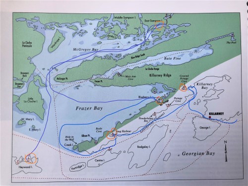
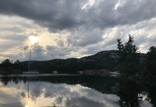
Our track through the North Channel so far: Kilarney, Covered Portage Cove, Blueberry Island in Frazer Bay, McGregor Bay and Heywood Island.
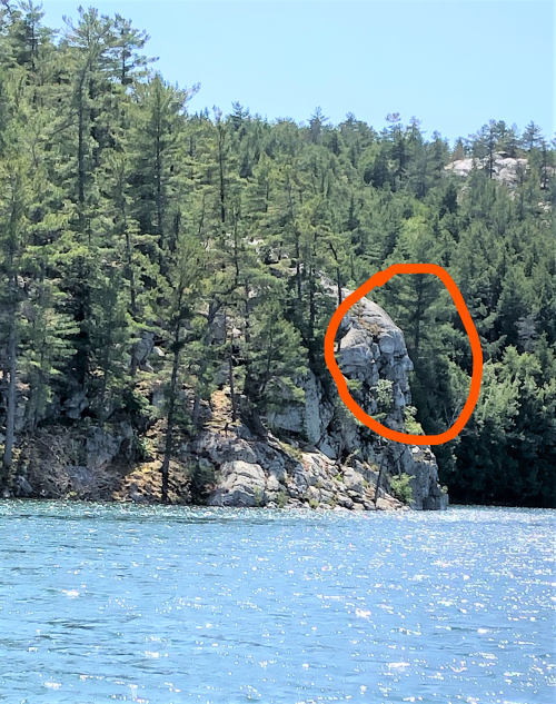
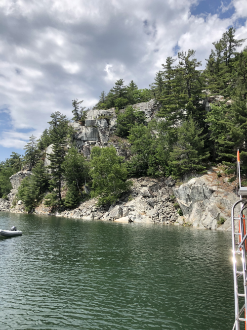
Someone told me the North Channel has fjords. Yes fjords, like the ones we marveled at in Norway last summer. I was skeptical, but as we passed the Indian Head (not sure if that’s ok to say, but that is what it is called here) that opened onto Covered Portage Cove, there they were, massive pink and white quartzite walls, soaring from the cold, clear water into the a blue sky. Maybe they are not quite as tall as the peaks in western Norway, but they are fjords none the less, right here in Ontario.
See the Indian Head’s profile?
Our first night was in Thomas Bay, just before Kilarney, so
technically yet the North Channel. A
lovely protected bay to ride out some strong winds and do some kayaking.
Several other boats shared the anchorage and we met our neighbors, Mike and
Roberta from Echo Beach, shared sundowners (more on sundowners later) and
swapped sailing stories and tips well into the night. We would have considered another night there,
but in the morning the big John Deere on the cliff behind us began digging a
foundation for a new cottage. Time to
move on.
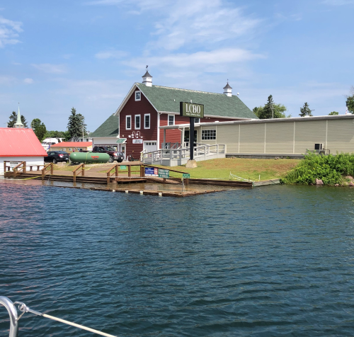
Kilarney is the gateway to the North Channel. The town consists of a few marinas, a couple resorts, a general store, a famous fish & chip restaurant and of course, a liquor store. What makes this town unique is all the businesses have docks for water access because that was the only way to get to this village before 1962, when the first roads were built. We cruised through on our way to our anchorage, but later returned in the dinghy – how can I pass up a boat-in LCBO?
Sail-up LCBO…but the docks are still under water due to the high water levels.
Covered Portage Cove (the emphasis on the second syllable, as it is a por-TAGE from this cove to the Frazer Bay, under a forest canopy). I need a thesaurus to describe Covered Portage Cove as I have run out of adjectives: breathtaking, awesome, magnificent, spectacular….the list goes on…Allen and I rate it a 10/10. We anchored in a very protected cove (winds were still gusting on the main channel), with still deep, clear water surrounded by fjords on one side and forest on the other. However, we were warned this cove can have up to 40 anchored boats, but fortunately the two nights we spent there with only about a dozen other boats, including our new friends, Echo Beach.
North Channel Fjords
We hiked to the top.
From the top of the fjord – Meshuggana is the boat nearest the bottom of the photo.
As we moved further west, the landscape flattens out, but remains heavily forested. Each anchorage is a little different than others, but all have something unique. Snug Harbour is a deep water cove (40 -50 feet deep), surrounded by a cedar forest that appears to have been uniformly pruned from the ground up. The pruning is not a result of human forest maintenance, but from deer munching on the trees. It’s called a “browse line” – the highest point a deer can reach to feed while browsing for food.
Look just above the water level – that’s the browse line where the deer have eaten all the branches and shrubbery.
The deeper we travel into the North Channel the less stable our data/internet connection. In some spots we are totally off the grid, no cell phone, no data, no VHF, and then, sometimes in the most unexpected places, full bars. Allen enjoys the solitude, and I like it in measured amounts and need to get back to civilization every few days. Next week – the BIG city of Little Current and friends visiting from Toronto!
Rocks near Blueberry Island in Frazer Bay.
Lots of submerged rocks…Allen walks on water in Landsdowne Channel.
Cat Stevens enjoying a dinghy ride in Covered Portage Cove.
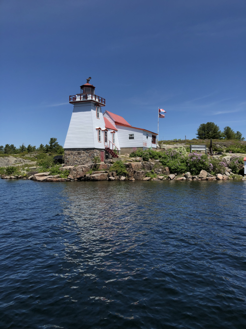
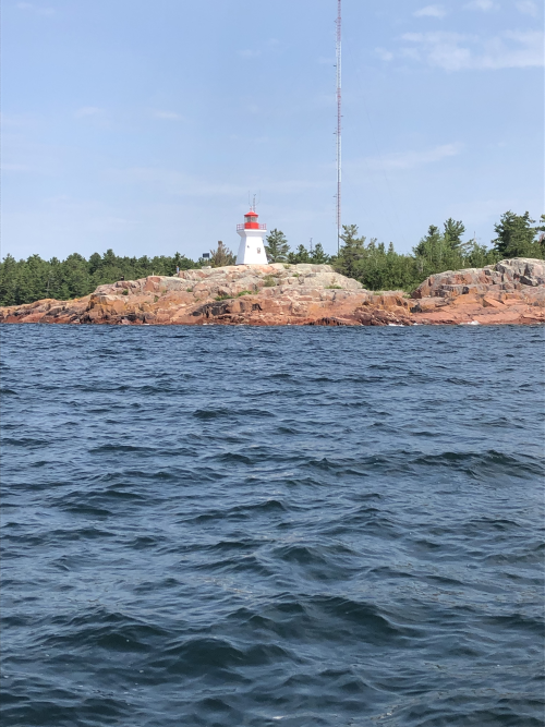
Kilarney Lighthouse
Great Loop – this is a long water journey that takes boaters from Florida, up the US coast, through the Erie Canal, across Lake Ontario, through the Trent Severn Waterway, then Georgian Bay, North Channel, Lake Michigan and then somewhere it joins up with the Mississippi River and goes all the way to the Gulf of Mexico. People who do this are called Loopers, and they are primarily power boaters, although we met a family doing this on a 42’ Beneteau sailboat. I hear it takes about a year to complete.
Sundowners – meeting your neighbors in an anchorage, going to one boat and sharing adult beverages and snacks as the sun goes down, sharing tips and stories. It’s the equivalent to checking into a hotel room, knocking on the door of the next room and asking them if they want to come to your room for drinks and snacks. Except it’s not creepy when you do that on a boat.
As we begin our 3rd week cruising the North Channel, I realize that I am ruined for Lake Ontario. Now, to be clear, I love Lake Ontario and we’ve sailed it end to end, Hamilton to Gananoque, both the New York and Ontario shores. I love sailing in Toronto, through the harbour with the impressive city-skape framing the water, dropping the hook in the Toronto Island lagoons and going for a bike ride, or the serenity of Humber Bay. A year ago I couldn’t imagine better place to spend a summer than on the boat in the Thousand Islands (for you non-sailors, the far east end of Lake Ontario and the start of the St. Lawrence River), with the seemingly endless rock islands and clean flowing water. However, I’m done with that now.
I mentioned in my previous post that we had heard of people describing the North Channel as one of the 10 best sailing areas in the world. We’ve spoken to some who don’t put in just top 10, but at the very top – the very best place to sail in the world. And this is coming from seasoned sailors, who have extensively sailed the world, Caribbean, Europe, South Pacific, but they keep coming back here. I can’t even count how many have told us they have been coming back here every summer for 20, 30 or more years. Why the appeal?
Sunset from Heywood Island
If you’ve been reading my posts, then you know that Allen
and I are in complete awe of the natural beauty of this area. Pink and white rocks, dense forests, the
clean scent of pine, fjords and endless places to hike or kayak. Water so clean and clear you can see the
bottom to 15 feet and could probably drink it, and if you like the words
“refreshing” or “brisk”, it’s a great place to swim. It also appears to be a good place to fish,
though as we are not into fishing, I can’t provide any first-hand commentary. There are lots of fishing boats, families
spending their evenings fishing from the docks, fish farms and every restaurant
in every town features white fish specials, so it must be good.
Meshuggana anchored by South Benjamin Island
Heading to The Pool at the end of Baie Fine
It’s also a place where power and sail boaters coexist quite
nicely (non-boaters may not know this, but this really is a “thing” – power and
sail boaters usually don’t mix well). All
kinds of boats can be found in the Little Current harbour, jet skis, small
fishing boats, sail boats of every size and vintage, big power boats and really
BIG boats, some 70 feet in length. Many
are from the US, including Florida, Georgia, Maryland, Virginia, Minnesota as
well as fairly local boats from Michigan and Illinois. Today we were treated to seeing the tall
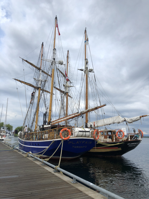
ships, Playfair and her sister ship, the St Lawrence.
Big boats in Little Current
Toronto
Brigantine Inc. operates the Playfair as a training vessel, as it was built solely
for this purpose. A brigantine is a two-masted square-rigged sailing vessel
with fore-and-aft rigged sails on the mainmast. The name comes from the Italian
word brigantino meaning a
pirate ship and was associated with the vessels favoured by them in
the Mediterranean. It was built in 1974, was christened Queen
Elizabeth II and aside from captain, the entire ship’s crew is between 13 and
18 years of age.
Tall ships Playfair and St Lawrence docked in Little Current
Local residents are friendly and helpful and we don’t sense
any resentment that folks living in tourist areas sometimes seem to feel. They are always willing to offer advice or
information and one woman, seeing me emerge from a grocery store with arms full
of shopping bags, offered to give me a lift to the docks.
Little Current at night
One of my farourite things is waking up just before 9 am to
tune into the Little Current Cruisers Net that broadcasts daily on VHF Channel
71 and can be picked up across the North Channel. For 15 years, Roy Eaton has been hosting the
program from Little Current, broadcasting weather reports and sailing
conditions, local and international news, local events, historical trivia,
sports scores and the best of all, asks all boats listening to call in with
their boat name and location. This
broadcast has provided us with valuable information on wind warnings, potential
hazards (such as bears seen prowling anchorages) and has given great tips on
what anchorages we should visit. If we
hear several boats calling in from one spot, we know it’s probably a great
anchorage, even though we may lots of company.
All boaters are welcome to join Roy for his broadcast, and last week
Allen and I had the pleasure of joining him.
The Pool at the end of Baie Fine
South Benjamin
Perhaps one of the most unique qualities of sailing the North Channel is being able to do just that – sail. As in sails up, main and jib, sometimes spinnaker, sometimes for hours. There are wide open spaces where you can sail, with no obstructions for dozens of miles, yet you know there will be another breathtaking anchorage waiting at the other end, offering safe harbour from the strong winds and currents. One can spend a decade of summers here and still not see every corner.
Next week we start our journey west, another week or so in the North Channel and then onto Lake Michigan. When we embarked on this journey we thought we’d make it to Chicago, but we will run out of summer long before we get that far. So, Northern Michigan will be our end point and the beginning of our journey home.